This hybrid model was developed within the framework of the
FuturAgua project:
an action-research project funded by the Belmont Forum and ANR.
Motivation
The
FuturAgua
project was implemented in Guanacaste, Costa Rica, between
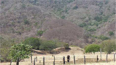
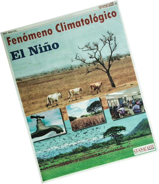
September 2013 and November 2017, with the aim of helping to
make better water use decisions so that communities are
prepared for periods of water scarcity in this drought-prone
region.
FuturAgua's focus was on generating information on the
current and future status of water in the region, and on
developing tools to support local governments and
communities in making decisions about water use and
management. In other words, it sought to build and generate
useful information to improve water security in Guanacaste.
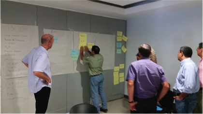
In order to involve community stakeholders to improve drought
resilience and reduce water disputes in the Potrero-Caimital Basin
in Nicoya, as well as to raise public awareness of water management,
a participatory process was developed that resulted in the
collective design of a computer model. "ContaMiCuenca"
is an interactive simulator that works like a game. The name of the
hybrid model, "ContaMiCuenca" is a play on words with a triple
meaning: "Tell me about my basin"; "Pollution of the basin"; and
"Count on me in the basin [co-management]". Its name reinforces the
use of the model as a frontier tool for communication and
understanding of the hydrological complexity of the basin.
Local stakeholders defined that ContaMiCuenca should address two
main issues: (i) the risk of groundwater contamination with
agrochemicals; and (ii) the reduction of water availability, for
basic human needs and agricultural production.
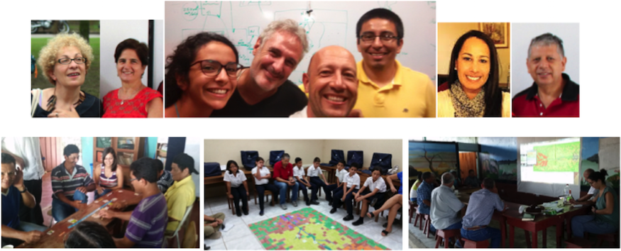
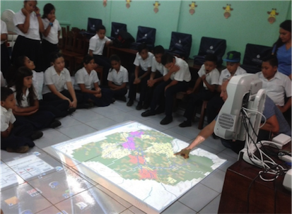
Photo: a collective design session of the model
(using the ARDI method)
A role-play session with students from Curime's
school.
Description and characteristics of the model
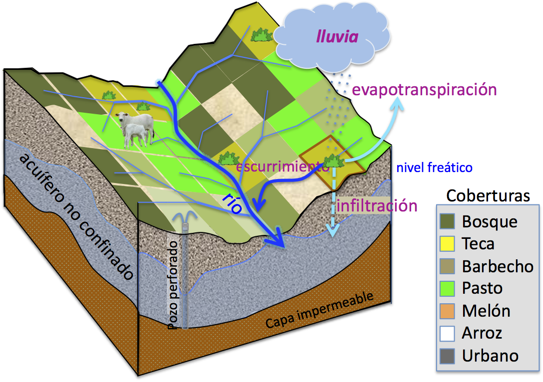
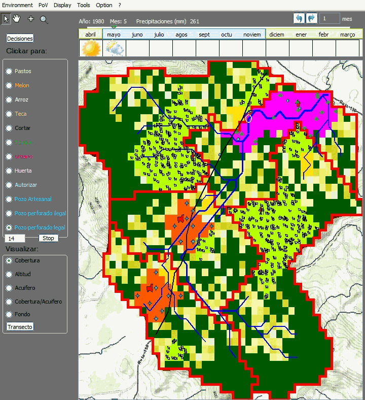
Hydrographic network of the Potrero-Caimital basin
The
Potrero basin is divided into plots of 2.25 ha (150 x 150
m2) and also into areas of activity. Depending on
the altitude of each plot, a hydrographic network receives
rainwater and drains it to the outlet. But some of the water seeps
into the soil (depending on the type of cover) and flows into the
aquifer. The model also calculates groundwater movements.
In addition, the model takes into account not only the quantities
of water, but also the quality by considering the concentrations
of chemical and organic contaminants.
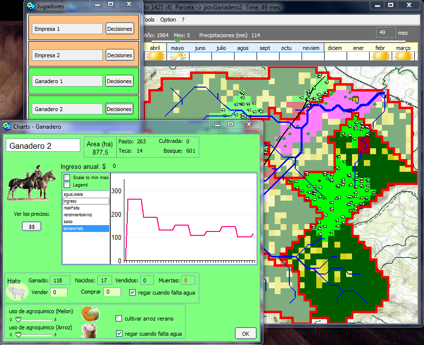
The agents
The model includes 6 agents divided into 4 types: 2 managers of
an agricultural industry; the village president; 2 livestock
farmers; and the city inspector (as the city is not located in the
watershed, it is not displayed in the simulation interface). Each
agent is in charge of a specific area: an area of activity
composed of plots.
ContaMiCuenca is a hybrid model in the sense that
it allows users to interact with the simulation. Thus, at any
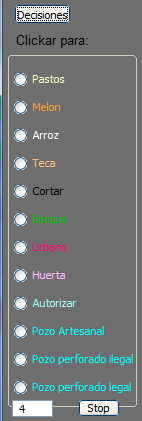
time, a player can open his decision interface. You can
define his strategy for the coming months. For example, a farmer
may decide to open new pastures, sell or buy cows and drill new
wells. Next, he must define where his decisions will be located in
his area of activity.
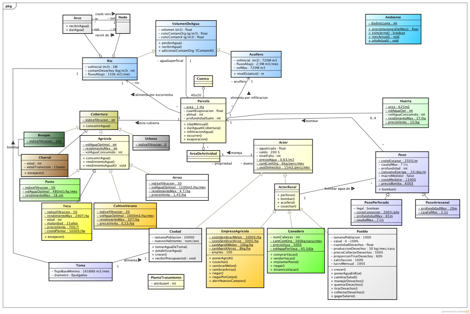
Structure of the model
The following UML class diagram presents the general structure of
the model:
Temporal dynamics
The water dynamics are as follows: each month, the watershed
receives a certain amount of rainwater (according to 10 years of
rainfall data from the study area). Each plot increases its volume
of surface water by this rainwater, then loses an amount of water by
evapotranspiration and by direct consumption by the vegetation
cover. Part of the remaining water is sent to the aquifer
(infiltration) and the other part to the river (runoff).
Each month, the vegetation grows, depending on the amount of water
available in the soil. Crops can receive fertilizers (farmer's
decision) that can increase yields to a greater or lesser extent.
Every semester, the crops are harvested and sold. When consuming
grass, cows also have a dynamic of reproduction, but also of
decrease if there is a lack of water or if the pastures are
degraded.
The farm sows rice at the beginning of the rainy season and melons
at the beginning of the dry season. Each player can also open new
plots to plant grass or teak.
Implementation
The multi-agent model, developed on the CORMAS platform, can
simulate the short and long term effects of water management, based
on a monthly time step.
Using the model
At the beginning of a simulation, a map of the Potrero basin is
automatically opened. Shows the spatial distribution of the
vegetation as well as the location of each player's activity
areas. The hydrographic system is also visible. Depending on
rainfall and aquifer level, river flows can fluctuate, which is
perceived by the size of the rivers.
The user is asked to choose a name and an agent-avatar.
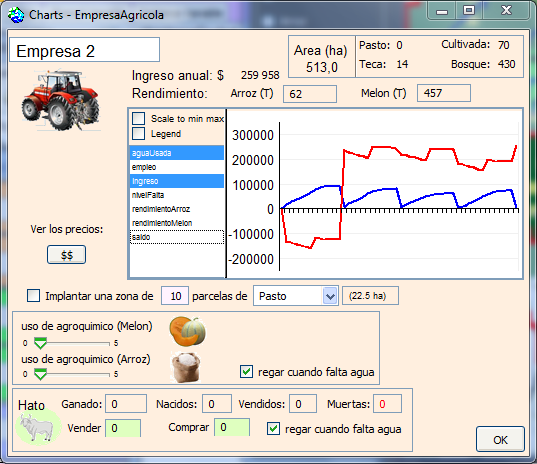
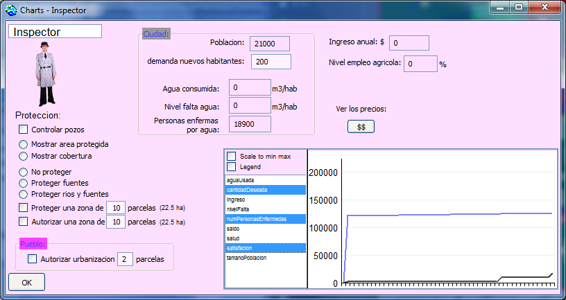
At any time, a player can know his status by opening his decision
interface where indicator probes are displayed (money, water
consumed, yields, etc.).
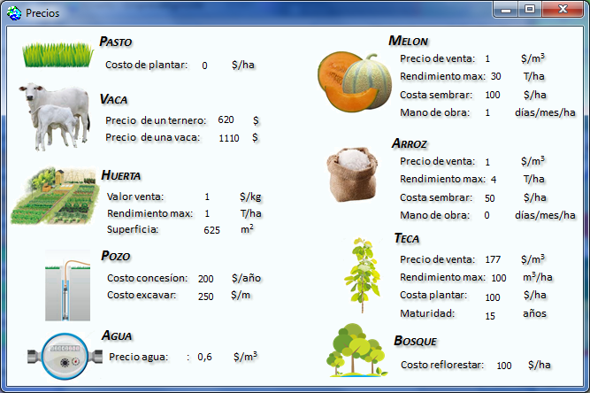
At any time, players can know the expected costs, needs and benefits
of each activity: